
This article was translated automatically from Italian.

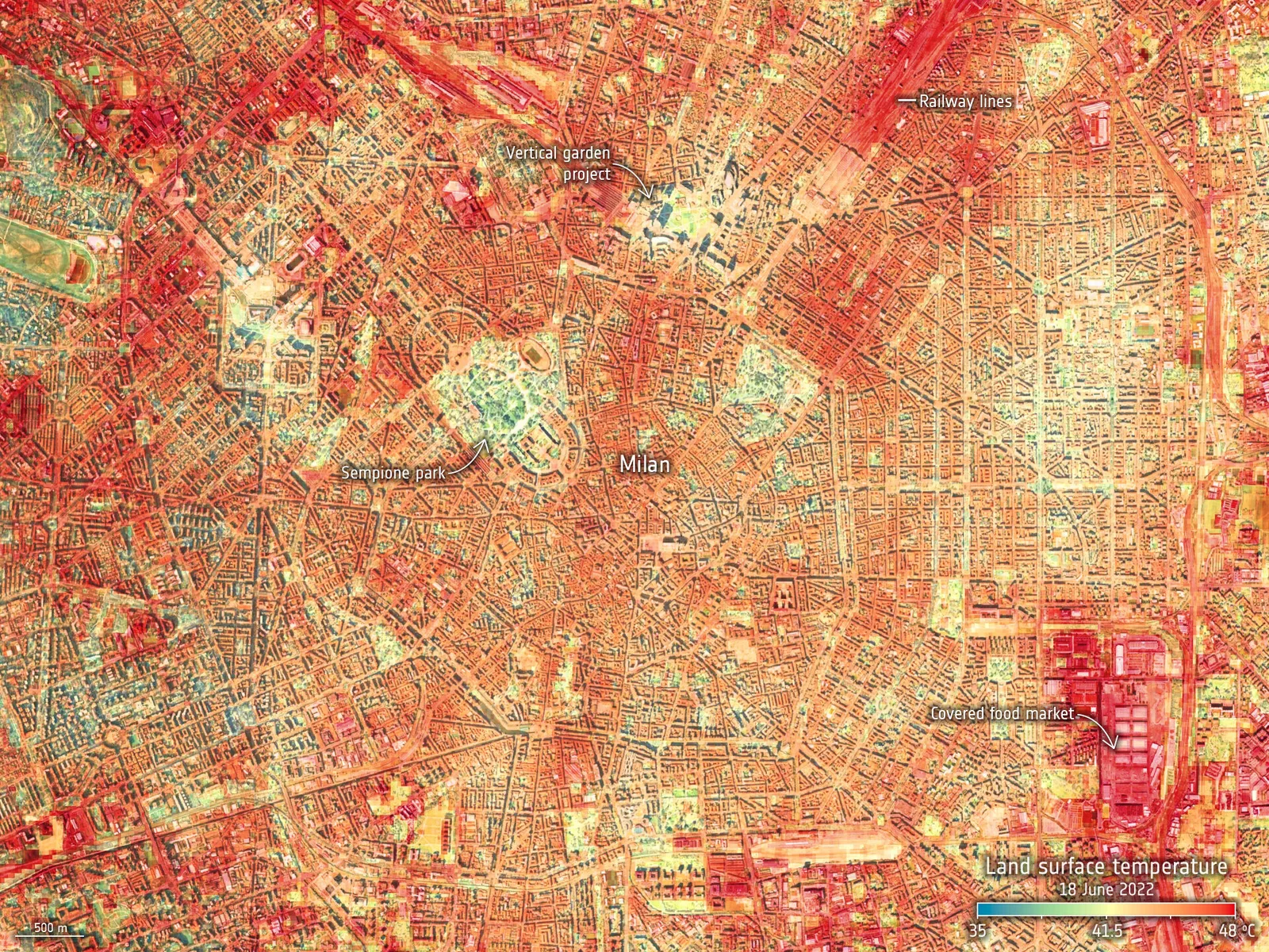
The ECOSTRESS instrument, installed on the International Space Station, has documented how the city's surfaces responded to record heat
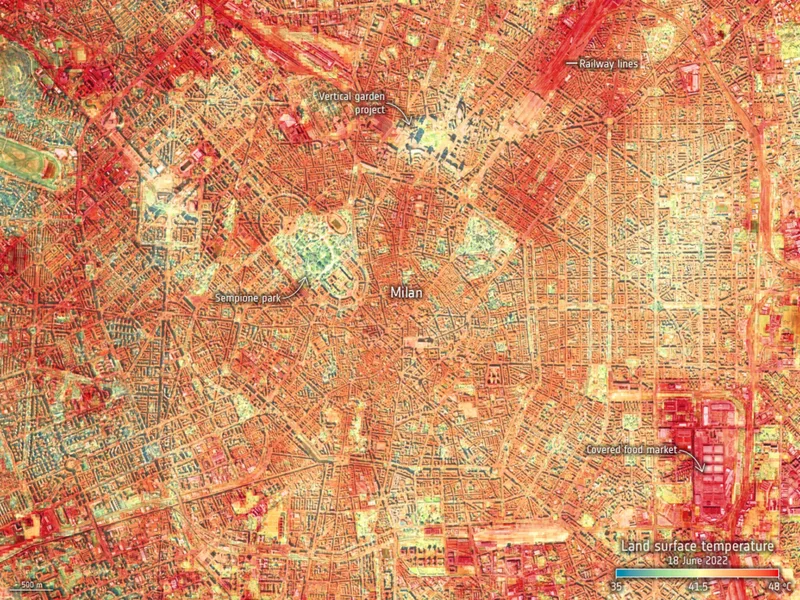
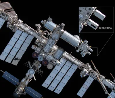
The ECOSTRESS temperature measuring instrument, installed on the International Space Station, has captured the recent extreme land surface temperatures for several European cities, including Milan.
The new data provide useful information for mitigating the effects of heatwaves and for planning water resource management more efficiently.
How ECOSTRESS came about
NASA's Jet Propulsion Laboratory in southern California built and manages the ECOSTRESS mission for the Earth Science Division of the Science Mission Directorate at NASA Headquarters in Washington. The instrument was launched to the space station in 2018. Its main mission is to identify the thresholds at which plants use water and experience water stress, providing information on their ability to adapt to a hot climate. However, ECOSTRESS is also useful for documenting other heat-related phenomena, such as patterns of heat absorption and retention.
The mission studies:
- How the change in the daily water stress of vegetation affects the global carbon cycle
- How the Earth's biosphere behaves with regard to water availability
- How the vulnerability of agriculture can be reduced through advanced monitoring of agricultural water use and a better estimate of drought
Plants regulate their temperature by releasing water through tiny pores in their leaves called stomata. If they have enough water they can maintain their temperature, but if there is not enough water, their temperature rises, and this rise in temperature can be measured with ECOSTRESS.
The results through the photos
ECOSTRESS images are the most detailed surface temperature images ever captured from space and can be used to measure the temperature of a single farmer's field!
ECOSTRESS takes advantage of the space station's orbit to obtain measurements at different times of the day, allowing us to see how plants respond to water stress during the day. The high-resolution images, with a pixel size of about 70 by 38 metres, are a powerful tool for understanding our environment.
The ECOSTRESS thermal infrared radiometer
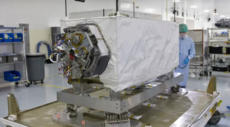
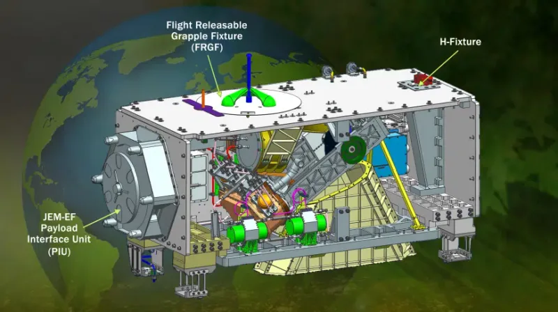
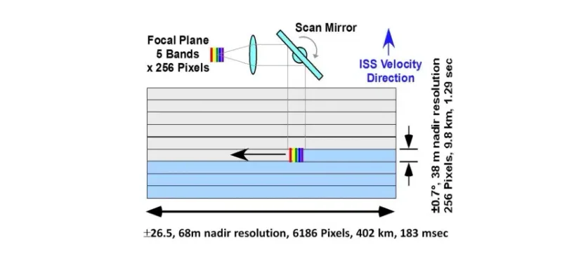
ECOSTRESS (ECOsystem Spaceborne Thermal Radiometer on Space Station) is equipped with the HyspIRI Thermal Infrared Radiometer (PHyTIR) installed on the International Space Station. From an altitude of about 400 kilometres, PHyTIR works by measuring the radiation emitted by the Earth's surface and provides data with a spatial resolution of 38 m in-track by 69 m cross-track and an expected temperature sensitivity of ≤0.1 K. In a typical 24-hour period, the instrument analyses an average of 22 target areas, each measuring 400 by 400 kilometres, for a duration of 1 to 11 minutes each.
The optical apparatus
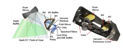
ECOSTRESS uses a scanning mirror and the optical signal is focused by a telescope onto the 65 K focal plane. It contains an array of custom mercury-cadmium-telluride (MCT) infrared detectors. The spectral filters on the focal plane define 5 spectral bands in the 8-12.5 μm range and an additional band at 1.6 um for geolocation and cloud detection (six bands in total).The focal plane is cooled by two commercial Thales cryocoolers.
How the images are made
The mirror then moves back and forth, using the forward motion of the spacecraft to build up an image. The image is 400 kilometres wide at right angles to the direction of flight. The instrument's field of view provides coverage from 53.6 degrees south latitude to 53.6 degrees north latitude around the entire Earth. ECOSTRESS is in a precessing orbit, which means that it acquires data at different times of the day, making it possible to determine how plants respond to water stress during the day.
How the colours of the photos are generated
The detector separates the energy from five different wavelengths, or spectral bands. This is possible thanks to filters inside the detector, thus producing five separate image colours for each point on the ground. The colours represent the intensity of the thermal infrared radiation emitted by the Earth's surface at each wavelength.

Alessandro Langella
Founder of Pavé, Milan
He knows Milan through years of hands-on market experience, properties visited and neighbourhoods watched as they changed.